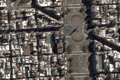
Google implemented a Beta version of Maps, an application to search satellite images of the most important cities in the world, Rome included [Clarin].
Related news > satellite views of famous architectures [archidose / Land+Living] /
Satellite images and national security > While the White House and Capitol Hill, in Washington DC, look covered or pixeled, in other cities buildings considered to be sensible targets are fully displayed [el mundo].